Monte Alban’s Ceremonial Plaza
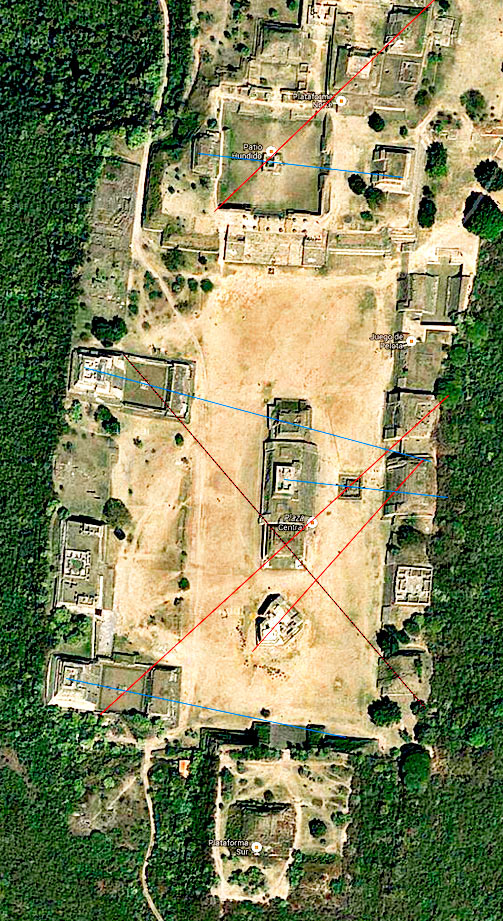
This satellite image show the central plaza at Monte Alban where all the main ceremonial buildings are found. The image certainly captures the city’s north/south alignment and you can also clearly see the vast Sunken Patio, a huge square hacked into the hilltop about a third of the way down the image. You can also see the oddly shaped and curiously aligned Building J just adrift below the three temples in the centre of the plaza.
(Borrowed from Google Maps 2014)

