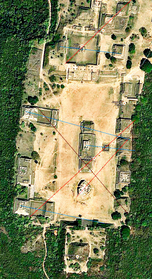
Monte Alban Satellite Image
This is a satellite image of the Main Ceremonial centre at Monte Alban which I have modified to show the number of curious alignments between the many monumental buildings around the main plaza. The blue lines could be aligned to sunrises on specific days. The red line from the odd shaped building in the centre of the plaza is known to have pointed at the heliacal rising of the star Capella. The other red lines follow a similar route and could point to other celestial risings whilst the dark line from System IV intersects the line from System M too perfectly over the top of Temple B for it to be a coincidence.
© Google Maps & Robin Heyworth