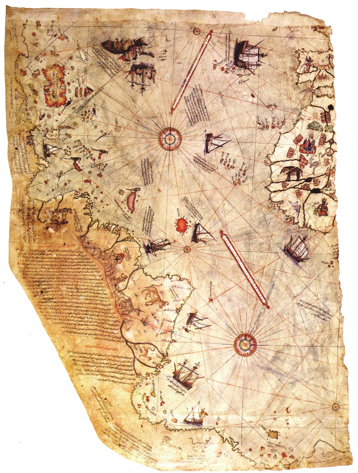
Piri Reis Map of 1513
The Piri Reis Map of 1513 which shows the recently discovered America’s. However it is the unknown lands across the bottom of the map that have raised eyebrows, with some suggesting that they accurately represent the landmass of Antarctica prior to the ice-sheets taking grip 8000 years ago. A more rational explanation is that the lands are the continuation of South America, which Reis drew around the bottom of the map because he had run out of room.