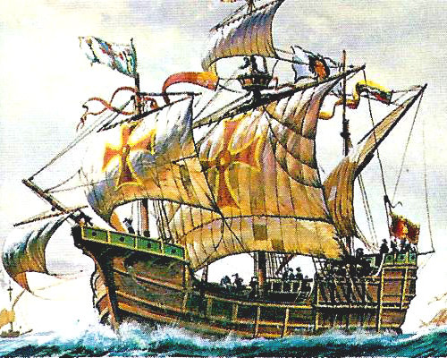
La Santa Maria – Columbus’ Nao-Class CarrackHistory books state that the Americas were discovered in 1492 when Christopher Columbus stumbled across a group of islands whilst searching for a route to India – this is why the island group he first landed upon is now called the West Indies. It is fair to say, that using the term “discovered” does cause some confusion, as parts of the Americas were as densely populated and as civilised as Europe – and had been for thousands of years. However, Columbus’ discovery of the Americas took place in a time when European monarchs were casting their naval fleets across the seas to “discover” new lands and trade routes to claim their own. United by Christianity, answerable to the papacy, and largely related to one another, Europe’s sovereigns operated a simple protocol of imperialistic expansion where the finding lands unknown to European Christendom could be claimed for their Kingdom. New lands and trade routes were becoming extremely profitable thanks to the huge ships that were being built which were able to venture onto the open seas carrying the manpower, firepower and resources to survive long journeys and stock up with precious cargoes for the return journey. Knowledge of undiscovered and unclaimed lands was highly prized and work to discover them was top-secret – some captains went so far as to draw incorrect maps to use during the voyage, thus preventing crew members or thieves from gaining advantage. Because of the clandestine clamour for the riches that new lands offered, the historical records are littered with misinformation, deceit and forgery.
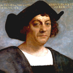
A Portrait of Christopher ColumbusJust how much deception and forgery Columbus was embroiled in is hard to tell as he was a very canny and reserved man. One thing is certain, he was not the heroic pioneer and adventurer that we may have been led to believe. His dishonest claim to be the first to sight new lands, his imprisonment, and his lifelong insistence that he had discovered part of Asia are all a testament to the kind of man Columbus was. Originally from Genoa (Northern Italy) Columbus had trawled Europe looking for sponsorship for his mission to find a western route to India. Trade in spices, opiates and silks from India and China had been fruitful to European merchants until the overland route known as the “Silk Road” had become blocked by the Ottoman Turks’ capture of Constantinople (Istanbul). Columbus’ plan was to discover a route across the western ocean which would offer his patrons exclusive access to the rich trade with India and China. In return for his efforts, he would be appointed Governor of any lands he discovered, receive 10% of all revenues earned and take the illustrious title of “Great Admiral of the Ocean” – terms which also reflect the kind of man Columus was and his real motives for venturing across the open seas.
The plan was rejected by several monarchs including King John II of Portugal, who rejected it twice, and Henry VII of England. It is thought their rejection was based on the expenses involved and concerns over the accuracy of the map Columbus’ was working from – also, the Portuguese had discovered a route around Africa that seemed far more realistic. Columbus’ was working on the principles and cartography of fellow Italian, Paolo dal Pozzo Toscanelli, which had been completed in 1474. 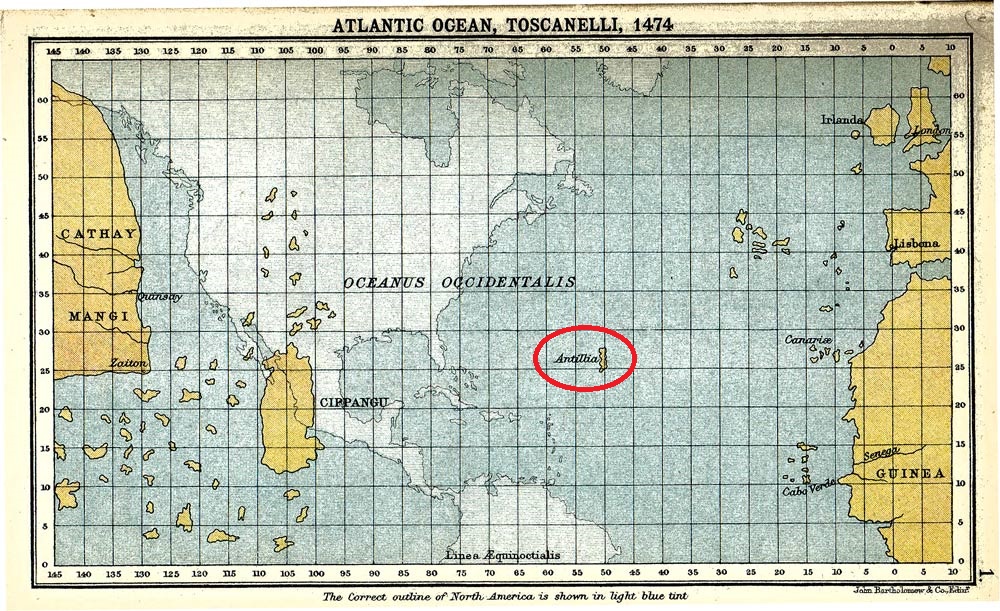
A Copy of Toscanelli’s Map of 1474 with Antilia circledThe map was designed to demonstrate Toscanelli’s belief of a western route to the “Spice Islands”, which he had supposedly learned of from people who had completed the journey. Of course, the Americas are famous for one particular spice, chilli peppers, so this may have led to the confusion. Interestingly, on his map Toscanelli included an island called Antilia, which looks like an early mapping of one of the Caribbean islands – which later became known as the Antilles. Antilia was a legendary island which had been visited by a group led by the Bishop of Porto in 734 who were fleeing from the Umayyad invasion. As they never returned, the story remained unknown until the early 15th century when a Spanish expedition landed there and found Portuguese speaking descendants who retold the story. Throughout the 15th century the Island features on maps, located in the middle of the Atlantic directly west from Portugal.
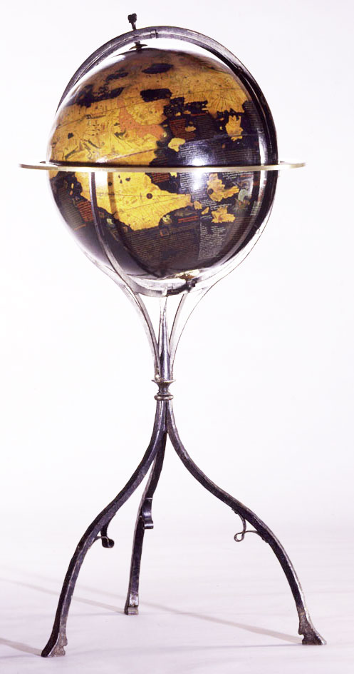
Behaim’s Globe of 1592The story of Antilia is recounted on Martin Behaim’s Edapfel, a globe constructed in 1492 from a linen ball laminated with wood and painted, which includes the legendary island and a short narration of the story. There are several errors that suggest Behaim used similar sources to Columbus and Toscanelli in order to construct his view of the world. The first, and most obvious, is the grossly underestimated distance to the Far East and the oversized island of Cipangu (Japan). The second error is that the Verde Islands are shown floating in the middle of the Atlantic when they should be much closer to the coast of Africa. The third “error” is the inclusion of the legendary lands of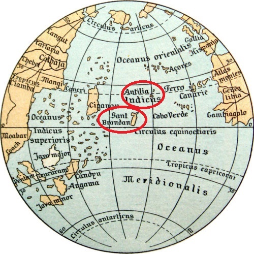
Transcript of the Behaim Globe with mysterious islands, Anitilia and St. Brandan, circledAntilia and Sant Brandan, the latter alledgedly discovered by St Brandan in a 6th century voyage to find the Garden of Eden. The first chronicles of these adventures were written in the 10th century and the story travelled across Europe becoming commonplace on maps of this era. These errors combine to make the journey from Europe to Asia appear quite plausible, especially if you were to stop at Sant Brandan on the way.
It is reported that Columbus’ miscalculated the size of the world by failing to convert the Arabic mile of 1820m into a Roman mile of 1480m whilst using a calculation outlined by Muslim astronomer Alfraganus in the 9th century, but the existence of the Erdapfel and Toscelleni’s map seem to show he was actually copying other works. The Muslims were far more scientifically minded and technologically advanced. During the Islamic Golden Age, between the 9th and 13th centuries, Islamic lands stretched from Indian Ocean to the Atlantic, including the Iberian Peninsula. This meant their trade and shipping routes stretched across the known world, from the western extremes of Europe and Africa to the far eastern lands of Asia and Japan. As well as an active knowledge of travelling and mapping the known world, they also held huge repositories of ancient texts within their territories (including the ancient Graeco-Roman libraries of Alexandria and Constantinople) and were the first to build universities, starting in 859. Armed with advanced knowledge of astronomy and maths, and with ancient and modern maps at their disposal, Islamic scholars were able to draught very accurate maps of the world.
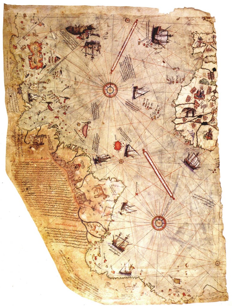
Piri Reis Map of 1513
One of the most famous Arabic maps is the Piri Reis map of 1513 which detailed the newly discovered Americas as well as the undiscovered coastline of Antarctica before the ice sheets covered it over. Scientists have calculated that the most recent period when the ice was receded sufficiently for the coastline to be exposed and mapped was over 6000 years ago1. Piri Reis used an astonishing 34 ancient maps in order to produce his map of the world, including ancient Greek and Roman maps which dated back to the 4th century BC and beyond. If Piri Reis had access to a map of Antarctica (a land which wasn’t “discovered” until 19th century), then it is reasonable to suggest that a map also existed somewhere in the world of the Americas – and would have most likely been in the possession of the Islamic libraries.
An Islamic map of the Americas or rumours of an Islamic expedition to western lands may well have triggered the motivation for Columbus’ expedition. For having been rejected by numerous monarchs, including Isabella I and Ferdinand II of Castile (Spain), Columbus’ proposition was eventually accepted by none other than Isabella and Ferdinand. The story goes that Isabella I had just rejected his plan for a second time on the advice of her confessor when Ferninand II intervened and sent a messenger after him. They hauled him back and accepted his plan and his somewhat outrageous terms in one of the most inexplicable and profitable U-turns in history.
Undoubtedly, the acceptance was triggered by Isabella and Ferdinand’s successful campaign against the Muslims in Granada which had won them the prized lands at the mouth of the Mediterranean. It also probable that after fighting the Muslims for ten years they were financially ruined and forced to gamble on Columbus’ unlikely success. But, if this was the case then they would surely have negotiated far better terms for 
A Wedding Portrait of Isabella and Ferdinandthemselves as it was an expensive expedition that they could ill afford, it was highly likely to fail because he had no idea how big the earth was, and having been rejected so many times he was in a very weak position to make demands. However, if Isabella and Ferdinand had captured Muslim maps detailing the Americas, with accurate calculations that led them to believe that Columbus could make it, then they would be the ones trying to broker the deal and Columbus’ would be in a strong position to get the terms he wanted.
Even without an existing map, there was plenty of reason to believe new lands lay to the west. Columbus had a map with two of those new lands on it – Sant Brandon and Antilia. The latter, Antilia, almost certainly takes its name from another great legendary land that was thought to lie in the western ocean – Atlantis. First written about in by Plato in 360BC, Atlantis has to be one of humanity’s most enduring legends, which to this day is still being discussed and searched for. Described as a huge land to the west that lay beyond the pillars of Hercules (the entrance to the Atlantic ocean from the Mediterranean), anyone searching for this land in antiquity would have been sailing off towards America. Whilst arguably the story of Atlantis has no foundation in history, some descriptions are in keeping with what Columbus eventually discovered, “a land greater than Africa and Asia” that was “surrounded by seven islands” (the Caribbean islands) perhaps suggesting an ancient knowledge of what existed to the west.
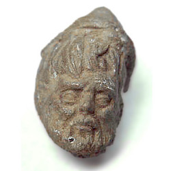
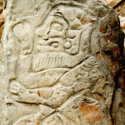
The Greeks, Roman’s and Phoenicians were all seafaring nations who were capable of crossing the Atlantic in ancient times – and they all had a culture that repaid heroism with eternal glory amongst the Gods to make it worth dying trying. The likelihood of them succeeding would have been small, and the chance of them completing the journey twice in order to return home and tell of their adventure would be miniscule. However, there are several famous instances which may be evidence that the journey was completed at least in one direction. These examples include: the African looking Olmec heads; from a the use of Roman clay-fired bricks complete with Roman “masons-marks” at Comalcalco2; a Roman bust found buried in antiquity at Calixtlahuaca which stylistically dates from around the 3rd century AD3; the imagery of white-bearded men found throughout the Americas; an inscription written in Phoenician found in Brazil which talks of their ship being lost in a storm and carried across the Atlantic; caucasian mummies found in Paracas, Peru; the presence of tobacco and cocaine, which were only known to exist in the Americas prior to Columbus’ discovery, found in Egyptian mummies4.
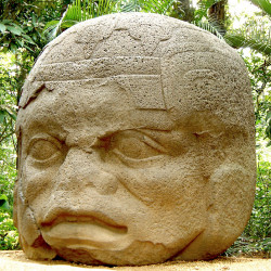
Olmec Head
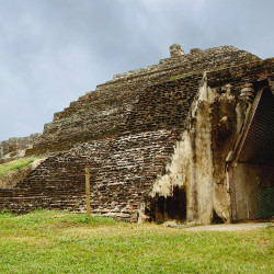
Comalcalco’s Roman Brickwork
Calixtlahuaca Roman Head
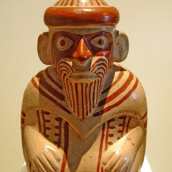
A Peruvian Pot
Bearded Man from Monte Alban
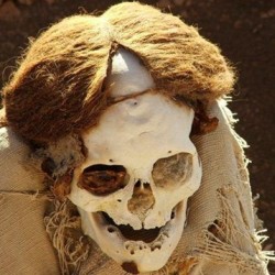
Peruvian Mummy
Curiously, the Egyptians are central to Plato’s description of Atlantis as his measurements are provided by Egyptian priests who have them written in hieroglyphs on the pillars of their temple. In fact, so central are the Egyptians to the story of Atlantis, that Plato was derided by his contemporaries as 
The Solar Barge of Khufuhaving bastardised the whole story from an Egyptian legend. Whilst Plato’s story is almost certainly fabricated to glorify the Athenians, this does not mean that the Egyptian legends weren’t true – and the ship found at the foot of the Great Pyramid certainly proves they had the technology to cross the open seas in great antiquity.
It is fair to say that the idea of ancient trade between the civilisations of the Mediterranean and the Americas is speculative, but there is one famous seafaring civilisation that definitely reached the Americas. Furthermore, the way in which their feat was dismissed adds great weight to the argument that other ancient Atlantic crossings have also been unfairly dismissed. The Vikings first settled in North America in the 10th century, but the stories of their expeditions weren’t recorded until the 13th century or 14th century when transcriptions of the Saga of Erik the Red and the Saga of the Greenlanders were written. The Sagas tell of an expedition undertaken by Leif Erikson in response to the sighting of land by Norse merchant Bjarni Herjólfsson, 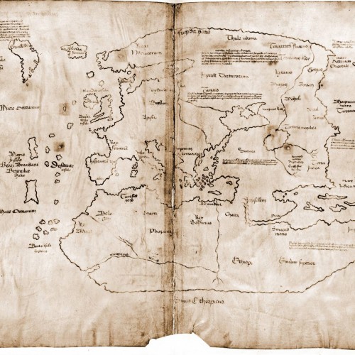
The Vinland Map who was blown off course whilst traveling from Iceland to the Viking colony of Greenland. Leif, the son of Eric the Red, bought the ship that Bjarni had been sailing and set off with a group of 35 men to start a settlement in the new lands which they called Vinland. Two further excursions followed, the first by Lief’s brother Thorvald, who attacked some natives and was later killed during a revenge attack, and the second by another brother, Thorstein, whose main quest was to retrieve his brother’s body – although he also stayed for a season. The fourth quest was completed in 1009 by Thorfinn Karlsefni, also known as “Thorfinn the Valiant”. He set sail with 160 men and women, plus livestock, with the intention of creating a more permanent colony, which he did.
The sagas were discarded as mythology by modern historians of the 19th and 20th century who wanted to move away from mythology as a source. Regardless of its marginalisation, 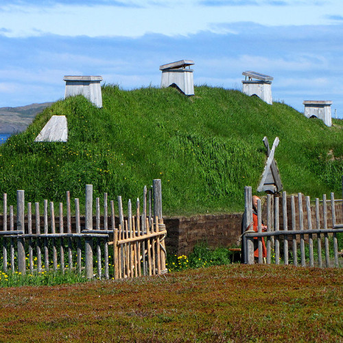
L’Anse aux Meadowsa Norwegian explorer named Helge Ingland went searching for the fabled Vinland amongst the coastlands of northern Canada and in 1960 a local fisherman took him to an “old Indian settlement”, now known as L’Anse de Meadows, in Newfoundland. Excavations uncovered a Viking settlement which dates exactly to the time of the sagas, providing evidence that the sagas were at least partly factual and that our modern interpretation of folklore being primarily allegorical is often unjustified and, in some cases, ignorant. We should certainly not dismiss the legends of Atlantis, Sant Brandon or Antilia, nor the theories of Roman, Phoenician or Egyptian expeditions to the Americas, as the evidence could be out there waiting to be uncovered or hidden away in a museum because it didn’t fit with orthodox history.
The story of Christopher Columbus voyaging to the New World is certainly a fact, but the idea of him stumbling across the Americas whilst looking for a route to India seems unlikely. Firstly, let’s look again at the terms that Columbus was given:-
“…if he succeeded he would be given the rank of Admiral of the Ocean Sea and appointed Viceroy and Governor of all the new lands he could claim for Spain…He would be entitled to 10% of all the revenues from the new lands in perpetuity. Additionally, he would also have the option of buying one-eighth interest in any commercial venture with the new lands and receive one-eighth of the profits”5
These terms certainly suggest his mission from the outset was to discover new lands and not an alternative route to India. We have looked at several maps that predate Columbus’ “discovery” and appear to have Caribbean Islands listed on them. We know that publicised sagas had been written about the Vikings visiting similarly placed and previously unknown lands. So new lands were known or at least thought to exist in the middle of the Atlantic. But, new lands alone do not provide wealth, and only a small patch between Mexico and northern Honduras and the islands off their coast were accessible from the Atlantic and worth “discovering”. So previous expeditions may have landed in the Americas and left again, considering the lands to be of no value – and this could be the real reason that Columbus struggled to gain support for his expedition.
In summary, it appears likely that new lands were thought to exist and that Isabella I and Ferdinand II’s dramatic U-turn could have been triggered by information captured during the expulsion of the Muslims from Granada. The information indicated there were wealthy new lands to the west that were so desirable they felt compelled to accept Columbus’ expensive terms. Columbus then set off with this information and discovered the lucrative and hospitable islands of the Antilles. On the other hand, the orthodox story suggests that Isabella I and Ferdinand II decided to gamble their remaining funds on a plan that was so flawed that the whole of Europe had rejected it, including themselves twice, but luckily rather than starving out at sea whilst sailing twice as far as he had calculated, Columbus’ stumbled across a the Mesoamerican kingdom making himself and Isabella and Ferdinand vast fortunes. In brief, this was either a calculated and well executed plan by a cunning and experienced captain of the seas, or, Columbus is the luckiest man ever to borrow a boat and get lost.
If you need evidence of Columbus’ cunning and corruption, then it is said that upon his return from “discovering” the Americas he claimed the lifelong pension for being the first to sight the new lands, when in fact it was a scout named Rodrigo de Triana on a completely different ship, the Pinto, who first spotted the shores. Columbus was also stripped of his titles in 1500 and investigated for atrocities including torture and genocide – one example states that he had the hands cut off slaves who were unable to pay his exorbitant tributes and then they were left to bleed to death. In his defence, the clamour for riches meant that false allegations were rife, so it may be unfair to believe every accusation levelled against Columbus. It is also quite probably that Isabella and Ferdinand were themselves quite keen to see Columbus discredited and imprisoned to relieve them of their financial obligations – and this is exactly what happened when they retracted the Capitulations of Santa Fe, which is the official name for the agreement.
Despite the atrocities hanging over his head following his first three missions, he was employed by Isabella and Ferdinand until 1505, by which time he had completed four missions.
References:
1 http://www.world-mysteries.com/sar_1.htm
2http://www.mexconnect.com/articles/1241-did-you-know-mayan-pyramid-in-tabasco-mexico-has-possible-roman-links
3 http://en.wikipedia.org/wiki/Tecaxic-Calixtlahuaca_head
4 http://en.wikipedia.org/wiki/Norse_colonization_of_the_Americas
5 Samuel Eliot Morison, Admiral of the Ocean Sea: The Life of Christopher Columbus, (Boston: Atlantic-Little, Brown, 1942). Reissued by the Morison Press, 2007. ISBN 1-4067-5027-1