Satellite Image
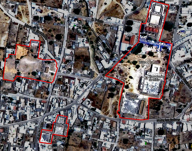
This is a satellite image of Mitla taken from Google Earth 2014 and edited to highlight the different sections of the archaeological zone. The main site is easily identifiable, as is the Church of San Pablo with its four red domes. Then bottom left is the South Group and to the West, the Adobe Group